About the project
Project Name: RiverCaptureFinder: a Python-based Tool for Tracking River Capture
Grantee: Renato Da Silva
Discipline: Earth and Environmental Sciences
Collaborator: Pedro Val
Funding Cycle: 2025-2026
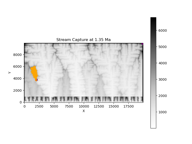
Summary: Rivers constitute dynamic systems that can adapt to climate and environmental changes via fluvial reorganization processes. These processes are linked to high biodiversity areas (e.g., the Amazon region); therefore, by constraining their drivers, one can bridge existing gaps between geology and biodiversity. Here, I will analyze river capture and divide migration, which are the most common and significant reorganization processes in landscapes. I introduce RiverCaptureFinder, a Python-based tool that automatically identifies river capture events and calculates topographic metrics, including drainage area, local relief, mean elevation, and slope, in numerical landscape evolution models. Although RiverCaptureFinder is under active development, it has already successfully identified river captures simulated over millions of years and stores this information in a structured data format that supports retrieval, post-processing, and visualization.